Overview of the NYC Subway System
The New York City Subway, operated by the Metropolitan Transportation Authority (MTA), is one of the largest and most complex public transit systems in the world. It is renowned for its extensive network, 24/7 service, and critical role in connecting the city’s five boroughs.
Key Facts
- Opened: October 27, 1904
- Total Length: Approximately 665 miles of track (in use)
- Lines: 36 subway lines across the city, identified by numbers (1-7) or letters (A-Z).
- Stations: 472 stations, making it the subway system with the most stations globally.
- Ridership: Millions of riders use the system daily, with annual ridership exceeding 1 billion passengers (pre-pandemic).
- Operating Hours: The NYC Subway operates 24 hours a day, 7 days a week.
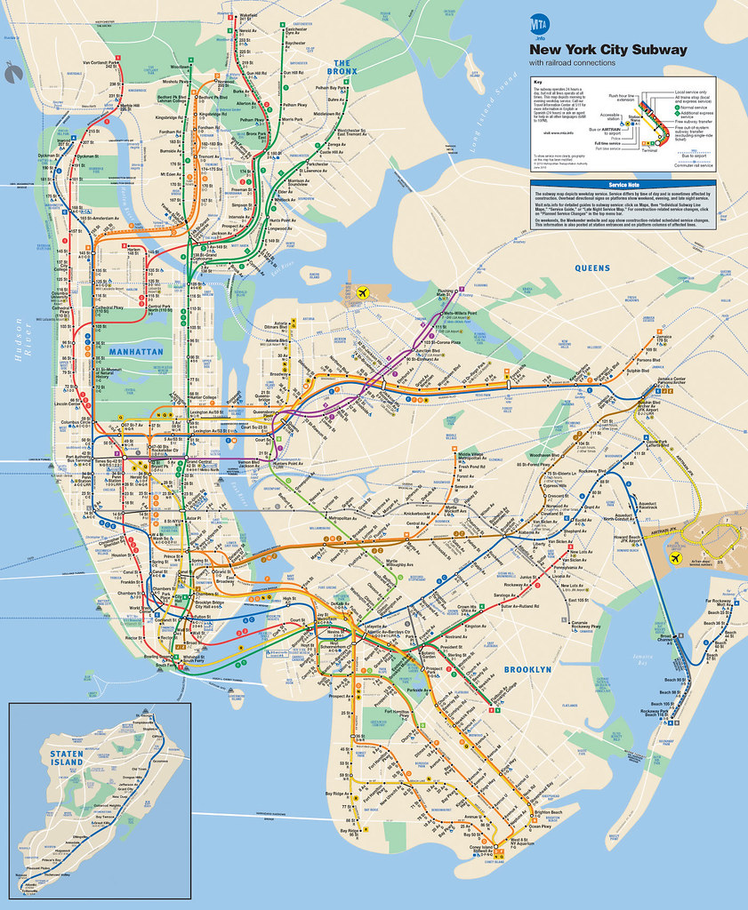
System Layout
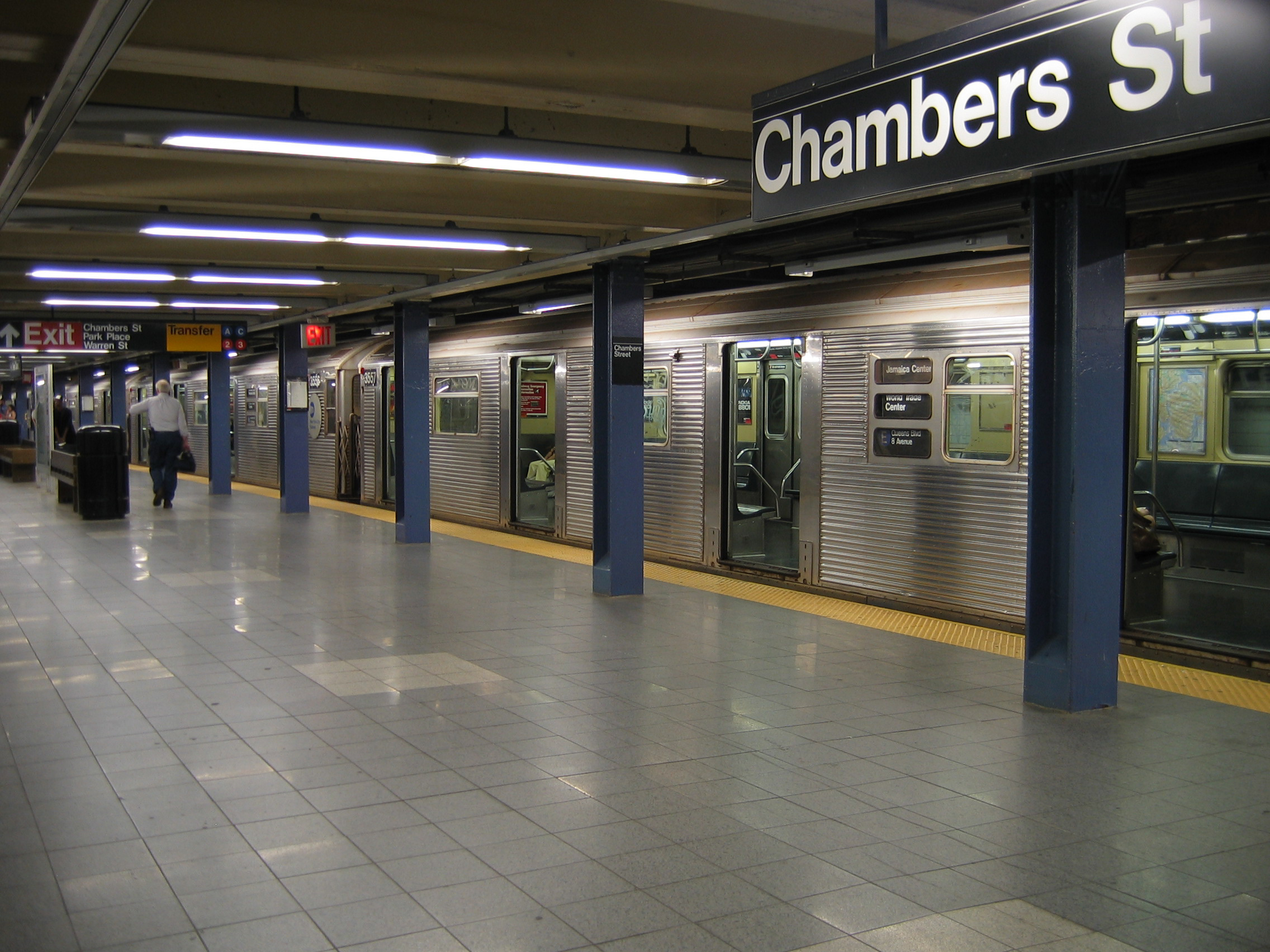
- Manhattan: The hub of the subway system, where most lines converge, serving both local and express services. Key hubs include Times Square-42nd Street, Grand Central Terminal, and Herald Square.
- Brooklyn: Connected to Manhattan via multiple lines, serving neighborhoods like Downtown Brooklyn, Williamsburg, and Coney Island.
- Queens: Features key transit hubs like Queensboro Plaza and Jamaica Center, with service to JFK Airport.
- The Bronx: Connected primarily by the numbered lines (1, 2, 4, 5, 6), serving areas like Yankee Stadium and Fordham Road.
- Staten Island: Served by the Staten Island Railway (SIR), which connects Staten Island to the Staten Island Ferry terminal.
Types of Services
- Local Trains: Stop at every station on the line.
- Express Trains: Skip certain stations to offer faster service, particularly during peak hours.
- Shuttle Services: Short train routes connecting key stations (e.g., 42nd Street Shuttle).
Notable Features
- Color-Coded Routes: Lines are grouped by colors based on their trunk line in Manhattan (e.g., Red for 1/2/3, Green for 4/5/6).
- Accessibility: Many stations now feature elevators and ramps, but a significant number remain inaccessible to passengers with mobility challenges.
- Integrated Payment System: The transition from the MetroCard to the OMNY contactless payment system is currently underway.
- Express Tracks: Many lines have dedicated express tracks, particularly in Manhattan and Brooklyn.
Interesting Facts
- Longest Line: The A train, running 31 miles from Inwood-207th Street in Manhattan to Far Rockaway in Queens.
- Busiest Station: Times Square-42nd Street, serving over 60 million passengers annually.
- Deepest Station: 191st Street (1 train) in Washington Heights, located about 180 feet below street level.
- Oldest Station: City Hall, a now-closed but preserved station that opened in 1904.
- Artwork: Many stations feature public art as part of the MTA Arts & Design program.
Subway Lines
Numbered Lines (1–7)
| Line | Color | Route | Key Stations | Type |
|---|---|---|---|---|
| 1 | Red | South Ferry (Manhattan) ↔ Van Cortlandt Park (Bronx) | Times Square, 125th St | Local |
| 2 | Red | Flatbush Ave (Brooklyn) ↔ Wakefield-241st St (Bronx) | Times Square, 149th St-Grand Concourse | Express |
| 3 | Red | New Lots Ave (Brooklyn) ↔ Harlem-148th St (Manhattan) | Times Square, Fulton St | Express |
| 4 | Green | Crown Heights-Utica Ave (Brooklyn) ↔ Woodlawn (Bronx) | Grand Central, 125th St | Express |
| 5 | Green | Flatbush Ave (Brooklyn) ↔ Eastchester-Dyre Ave (Bronx) | Grand Central, Fulton St | Express |
| 6 | Green | Brooklyn Bridge (Manhattan) ↔ Pelham Bay Park (Bronx) | Grand Central, 125th St | Local |
| 7 | Purple | Flushing-Main St (Queens) ↔ Hudson Yards (Manhattan) | Times Square, Grand Central | Local/Express |
Lettered Lines (A–G)
| Line | Color | Route | Key Stations | Type |
|---|---|---|---|---|
| A | Blue | Inwood-207th St (Manhattan) ↔ Far Rockaway (Queens) | Times Square, Fulton St | Local/Express |
| C | Blue | 168th St (Manhattan) ↔ Euclid Ave (Brooklyn) | Times Square, Fulton St | Local |
| E | Blue | World Trade Center (Manhattan) ↔ Jamaica Center (Queens) | Times Square, Lexington Ave-53rd St | Express |
| B | Orange | Bedford Park Blvd (Bronx) ↔ Brighton Beach (Brooklyn) | Times Square, Grand St | Local/Express |
| D | Orange | Norwood-205th St (Bronx) ↔ Coney Island (Brooklyn) | Times Square, Atlantic Ave-Barclays Center | Local/Express |
| F | Orange | Jamaica-179th St (Queens) ↔ Coney Island (Brooklyn) | Times Square, 14th St-Union Square | Local/Express |
| M | Orange | Forest Hills-71st Ave (Queens) ↔ Middle Village (Queens) | Rockefeller Center, Delancey St | Local |
| G | Light Green | Court Sq (Queens) ↔ Church Ave (Brooklyn) | Bedford-Nostrand, Hoyt-Schermerhorn | Local |
Shuttle and Special Lines
| Line | Color | Route | Key Stations | Type |
|---|---|---|---|---|
| S (42nd St Shuttle) | Gray | Times Square ↔ Grand Central | Times Square, Grand Central | Shuttle |
| Franklin Ave Shuttle | Gray | Franklin Ave ↔ Prospect Park | Franklin Ave | Shuttle |
| Rockaway Park Shuttle | Gray | Broad Channel ↔ Rockaway Park-Beach 116th St | Broad Channel | Shuttle |
Relationship Between Numbering and Color Coding
- Color Coding:
- Each color represents a trunk line (a central route shared by multiple services) in Manhattan.
- For example:
- Red: The 1, 2, and 3 trains all use the Broadway–Seventh Avenue Line in Manhattan.
- Green: The 4, 5, and 6 trains all use the Lexington Avenue Line in Manhattan.
- This helps passengers identify which trains follow similar paths through central areas of the city.
- Numbering (or Lettering):
- Each number or letter represents a specific service (a distinct route with defined stops and endpoints) that operates on a trunk line.
- For example:
- The 1 train runs local, while the 2 and 3 trains run express on the same red-colored trunk line.
- Combining Color and Numbering:
- The color provides a high-level guide to the trunk line.
- The number or letter distinguishes between local, express, or unique routes on that trunk.
Key Examples
| Color | Number/Letter | Trunk Line | Service Notes |
|---|---|---|---|
| Red | 1, 2, 3 | Broadway–Seventh Avenue Line | 1 is local, 2 and 3 are express. |
| Green | 4, 5, 6 | Lexington Avenue Line | 6 is local, 4 and 5 are express. |
| Blue | A, C, E | Eighth Avenue Line | A is express, C is local, E serves Queens. |
| Orange | B, D, F, M | Sixth Avenue Line | Services split after Manhattan. |
| Yellow | N, Q, R, W | Broadway Line | N and Q are express, R and W are local. |
| Purple | 7 | Flushing Line | 7 offers local and express services. |
| Gray | S (Shuttle) | Varies (e.g., 42nd St, Franklin Ave) | Short-distance shuttle routes. |
How Color and Numbering Help Passengers
- Color:
- Guides passengers to the trunk line, useful for navigating Manhattan where many lines converge.
- Example: All green trains (4, 5, 6) run along Lexington Avenue.
- Number/Letter:
- Helps passengers distinguish specific services on the same line.
- Example: The 1 stops at all local stations on the red line, but the 2 skips certain stops as an express.
Why This System is Effective
The dual-use of color coding for trunk lines and numbers/letters for specific services:
- Reduces confusion in complex areas with overlapping routes (like Midtown Manhattan).
- Allows flexibility for service adjustments (e.g., express or local changes) without altering the overall color-coded map.